Wednesday 14 March 2018

Day 39 - Lake Selfe to Hamilton Hut, 21.8km, 4 hours 45 minutes


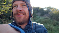
In the morning we had bellbirds literally surrounding our camp site on all sides. For someone who has planted their garden to encourage them but never seen one at home, it's a rather magical experience. I took some video but can't post that to my blog, so you'll have to put up with the rather enthralled selfie I accidentally took while filming.
You'll see I'm rather well rugged up - there was another light frost last night and I'm now consistently feeling cool in the hours before dawn. Definitely time to switch to my 4 season sleeping bag next time I'm home. The 3 season I bought for this trip might be 3 season in Auckland, but not down here!

We had a little more road walking first thing this morning to the Harper river.  This took little more than an hour, then with a quick shortcut to the river bed at shaved off a needless few kilometers by fording the river early, the first of several fords of the Harper we were to do, before starting to follow it upstream along the Birdwood Range.

Until we got further into the mountains later in the day the walking wasn't particularly interesting, although Mount Olympus grew progressively more spectacular as we approached it. Despite the relative mundanity I quite enjoyed the walk, invoking as it did very pleasant memories of tramping this valley and the valleys around it as a kid. This is very much my tramping home patch.

After lunch and a couple of (very cold) swims at the Avoca River confluence, where there is a quite spectacular t-intersection of valleys, we continued on past a local landmark, the pinnacles.


I enjoyed the valley more and more as we got further up river and towards the Hamilton Creek confluence.

Just past the confluence, at the point where there used to be a 3 wire bridge - never really required (it was always easier to just ford the river; if the river is too high to ford here you should probably be staying put anyway), but who can resist the fun of a 3 wire bridge; I've never not used it - in any case I digress, the 3 wire bridge has been replaced with a boring footbridge. RIP. To get back from my digression and then my subsequent sub-digression to my original point, this ex-3 wire bridge, now boring suspension bridge, marks 800 km of trail!

That's 500 miles, more or less. So yes, I WOULD walk 500 miles, but unhappily I wouldn't walk 500 more, there's only about 300 left until the end.

So that brings us to the Hilton, the affectionate nickname used by Canterbury trampers for the Hamilton Hut. Built in the early 1980's, it was the first modern style hut built in Canterbury. This means I'd have started using it when it was pretty much brand new. With its wide deck, awesome fireplace (since converted to a very effective pot black stove), convenient drying rack, running water!!!, and extensive views towards both the Cass and Lagoon Saddles, it made quite the contrast to the 4 and 6 bunk, draughty forestry huts we were used to. It still stacks up as among the best huts on the TA, a match for the Greenstone Hut - pretty much a great walks standard hut, and only bettered by the brand new huts on the Motutapu. Needless to say, it's great to be back!


There are 3 SOBOs in - all French (there are lots of French in trail - and like seemingly many Frenchmen they're a bit weird. They have said essentially nothing to us - I get the distinct vibe that they see us as not meriting their time. In any case a hearty hello on arrival was greeted by a "humph" , and a warning at dinner that a pot was boiling over with nothing at all, just a sullen saunter to the pot. After that I gave it up with the conclusion that THEY weren't worth MY time.
To the tune of the Fawlty Towers German episode, "Don't mention the Rainbow Warrior. Don't mention the Rainbow Warrior". I don't want to write off a whole country - I've met some wonderful French people - and I will admit to being a little pre-disposed given the whole "we'll blow up a ship in your harbour in a blatant act of war within a generation of thousands of your young men dying to help free our country (twice)" thing, but generally I find I dislike the French. Sorry for any of those of you with connections. If it's any consolation I'm half Dutch and I really don't like many of them much either. Off point again. SOBOs. There is a definite trend for less of them, I think I'm through the hump which is good news for hut space. The 3 today is the most I've seen in some time. I think the most I saw in one day was 12 on the south side of the Rangitata River.

Enough blabbering for the day...

Day 38 - Rakaia River to Lake Selfe, 23.8km, 6 hours 15 minutes


I might be getting spoiled for scenery, but this was a frankly tedious day of road walking.

The highlight of the day was Karen's 2 part breakfast.  I've had a luxury night tucked up off track after Karen and the kids picked me up from the south bank of the Rakaia. I started breakfast with fried new spuds dug from our garden and left over from the excellent slap up meal Karen put on last night. Yum!
Seconds were Easter French toast, somewhat of a tradition in our family. I'd better explain. Years ago when the kids were young we were on our way up to Motueka for Easter, and stopped beside the Motueka River to camp the night. The next morning we realised we hadn't brought anything for breakfast. Nothing for 2 hungry young boys! Scrounging around we came up with a loaf of bread, but alas no fishes, just some eggs and a big bag of those hollow Easter eggs that are pretty meh, but nevertheless not to be touched until Easter Sunday. In desperation we broke this golden rule and broke up the eggs to be used on French toast, as a kind of replacement for maple syrup. Amazing, and now we do it every year. However this year I'll be somewhere around the Nelson Lakes come Easter, so Karen brought it forward. Yum, yum, yum!

Anyway, to the walking. I hadn't put two and two together on this, but starting beside the Coleridge Power Station on the Rakaia River, and then traversing the length of Lake Coleridge during the day was always going to take a steep climb to start with. So the 200 meter climb was a bit of a rude start to the day, albeit climbing through a quite lovely Arboretum.

I've got a soft spot for a decent Arboretum having lived beside one in Kaiapoi. This one was rather more dishevelled and probably the better for it. The climb was accompanied by the caw of numerous magpies. It invoked memories of walking to primary school which, at least in my memory, was always accompanied by magpies. In any case it wasn't long before views of the Rakaia opened out behind and then the deep azure of Lake Coleridge in front.

Then down to the lake for the first of 3 swims for the day - this one rather chilly and cold, probably the coldest of all the lakes so far. With a 10am walking start and a big day of walking ahead keeping the swim to a quick one was probably a good thing though.

So far, so good. But that was only the first 5 or so kilometres and all the rest was on gravel road. What's more, being Sunday the road was hideously busy, with a car every minute or two.  There was a lot of transitioning between the margin and the road.  Most drivers were very considerate and slowed as they passed, receiving a wave of thanks as they did so. A couple weren't quite so great, and would roar past within a coupe of metres at top speed. I refrained from sending a different wave their way.
One very excitable Dutchman pulled his campervan up in the middle of the road, overjoyed at meeting real life Te Araroa walkers, then proceeded to get his wife to take photos. It's all part of the service. I'm still looking for my first offer of a ride though. Not that I'd accept one, but female TAers are apparently offered rides all the time while road walking. Me, not so much. Oh well, at least I can pee pretty much anywhere I want 😀.

There really isn't much at all to say about this section. It was there to be walked, so we walked it.


Mid afternoon and low on energy we stopped for an extended break at the Ryton River for swim, lunch and an hour of badly needed lazing around.

Carrying on, things got slightly prettier as we got to a series of lakes, the pick of which was Lake Selfe. With a name like that it'd be rude not to.

At the far end of the lake we still had another 6km or so of walking to the nominal campsite for the evening at the Harper River.  The campsite was described in the trail notes as 'grim', the highlights being a water tap, a toilet, and a line of pines to camp under. Hmmmmmm. Grim indeed. A high country lake sounded many times better. So Neil and I started looking. The problem is that the lake had many 'no camping' signs and many fishermen patrolling the shores. Our luck was in between Selfe and the next one on, Lake Henrietta - where we found an area that had no 'No Camping' signs.  I'll take that as positive affirmation!

One quite pleasent, but potentially eel filled (lots of weed), lake swim later I had another culinary highlight with some of Karen's Russian fudge with a hot chocolate for dessert.

Finally I leave you with an interesting image - the inside of my sleeping bag. Looks rather womb like to me.

Sunday 11 March 2018

Day 37 - Comyn's Hut to Rakaia River, 14.5km, 3 hours 30 minutes

The view from Turtons Saddle down to the Rakaia and Wilberforce River beds. It's 5km of riverbed across to the far mountain range.
An easy day in prospect, just need to nip up a saddle then down to the Rakaia River. The day dawned beautifully fine, if somewhat cold with a small frost on the ground. Still a welcome change from yesterday!


Early on we passed a SOBO. A woman in her early to mid twenties. Very small pack, apart from the bow mounted to the side. Turns out she had a possum trap too and was largely living off the land. Very impressive. I'm still not keen to try possum meat though.

We made progress up valley, easy and picturesque walking.


A cricket hitched a ride on my pack for 2-3km, spending its time chirruping right by my ear. I didn't mind it for the novelty - it reminded me of those Bernstein bears stories like Just Me And My Dad, where there is always a cricket involved.
We arrived at A-frame hut for an early lunch. It's a cute hut, but given that it only has 3 bunks and there were 2 people in residence last night I'm glad we didn't push on to it!
Then a small climb up to Turton's Saddle and a fine view both down to the Rakaia River, and back the way we had come from.


I was in very familiar territory now, having hared up to this saddle on a reconnaissance trip shortly before starting the trail.  That time I was meandering back down to the Rakaia to rejoin my family when I was surprised by a sudden thunderclap directly overhead.  I hadn't noticed the coming over the saddle behind me.  It certainly got the adrenaline going!  I ran off down the hill and all the way back to the car which was parked at the river, with the storm reverberating close behind.


Back to the current trip, the river itself is not safely fordable.  I remember trips as a boy crossing the Wilberforce River, and it is possible to go upstream and tackle the two rivers separately before their confluence, but it is a big river and I was not keen to do so.  So Karen and the boys picked us up.  We're staying for the night near Windwhistle at a nice little place, before being dropped to the north bank of the Rakaia tomorrow.  The room Karen and I are using has a Juliet balcony, which I have to say, I could get used to!


Saturday 10 March 2018

Day 36 - Double Hut to Comyn's Hut, 16km, 5 hours 20 minutes


Mirrors are totally unnecessary in huts - nobody cares what they look like. Nevertheless the Double Hut toilet had one I approve of.


Every longdrop should have a rear vision mirror!

It was a cold and windy day. With some climbing to be done, up to a height of 1500 meters, and snow forecast to fall down to 1800 meters, it was definitely a day to rug up.

 The prospect of climbing to high level in tussock and mud with sandals on account of my cut up feet didn't exactly fill me with joy.


Early on in the day we caught up with Teresa, a kiwi who I hadn't seen since Southland, and would shortly be leaving the trail. We grouped up and formed a chilly party.  The snow prediction was bang on - we were at about freezing level.

The saddle we were climbing, Clent Hills Saddle, just kept on giving. It looked like you were climbing to the peak, before it would dip down and send you up again. This happened numerous times, leaving us at chilling at altitude for longer than was ideal.


Eventually we reached the top, me sliding all over the place on the mud and tussock in my sandals. Not wanting to face this downhill I changed into boots at the top, as well as donning an extra base layer for warmth.  Mercifully after applying more tape my feet didn't feel too bad in the boots.


Then it was down to the north branch of the Ashburton River through very wet and cold waist high tussock. The trail description called for a very specific 51 fords of this river in the 7km we had to cover to get to the next hut. We scoffed at this as an obvious apocryphal number; more fool us. On a beautiful day I'd have really enjoyed it. As it was, it was more to be endured as we descended through a gorge. Fortunately the river wasn't too high, each ford coming little over my knees. Still, there was no chance to warm up!


The gorge came out at Comyn's Hut. Ideas of pushing on to A-frame Hut disappeared when we saw the hut had a fire and some scroungable wood. One somewhat smokey hut later I was enjoying the first fire I've had on trail.

Week 5 Summary

6 days walking, 1 zero day, not counting a hiatus home off track. All up 111km covered.

An experiment with new inner soles has left my feet in vulnerable shape, necessitating use of sandals in less then ideal terrain.

However I've come into a section where I'll be getting home a fair bit, and also know the trail very well, so the next couple of weeks should be easy travel.

Day 35 - Paddle Hill Creek to Double Hut, 23.2km, 5 hours 45 minutes

Maori Lakes, close to the Ashburton/Hakatere River.  A beautiful area.
The good news is that walking in sandals was no issue for my badly mangled heels, albeit today was largely easy terrain with just a small ridge to climb over.

The day started out by dropping into a large basin surrounded by mountains, rather reminiscent of the Hanmer Basin, whereupon the 700km milestone was soon crossed.


Crossing the Ashburton River we then came to a quite lovely section close to Lake Heron called the Maori Lakes, providing stunning views into the large mountains and remnant glaciers of the Arrowsmith range.

We had a few more kilometres of road walking to negotiate, with any luck the last for some time (Rakaia River south bank not withstanding - it's currently blocked from cyclone damage).

This led back into the hills and a late lunch at Manuka Hut, a great spot.

We weren't staying though, we had a lazy 5km to negotiate to Double Hut, which has spectacular views down to Lake Heron.


One final note of interest. I had heard rumours of Ed Hillary's scrawl in Double Hut. I found it, and it is old, but it looks fake to me. Amongst other things, Hillary is usually spelled with 2 l's. I'll let you decide for yourself.


Tomorrow we get into some more difficult terrain. I've decided to attempt it in sandals, and only switch back to boots as a last resort despite Neil finding me some left behind inner soles in the hut here that will do a job quite nicely if required.

Day 34 - Rangitata River to Paddle Hill Creek, 18.5km, 5 hours

Climbing north, away from the Rangitata River.
Starting in Rangiora, we first had a drive back to the trailhead on the north bank of the Rangitata River.

Mt Sunday is close to the trailhead, famous as Edoras in the Lord of the Rings films. I was keen for a look and so was Neil so we diverted for an hour or two to join the thronging masses. I'm fairly sure this must be the most climbed mountain in New Zealand. Actually it's interesting that it's called a mountain, it's only 80 meters above the river plain.

Then it was lunch at the trailhead, bye to mum and dad, who'd very graciously come along to take the car home, and setting off on the actual trail at 1pm.


While in town I'd replace my boot inner soles, which were starting to get into a sorry state. Unfortunately the new ones were a complete disaster. They lifted my heels enough that my boots would wear at the heel on both feet like sandpaper whilst climbing. Within 20 minutes of walking I had an issue, taping didn't help and when I stopped to remove the inner soles after 40 minutes both heels had literally been cut open, creating by far the worst blisters I have had so far on trail. I walked the rest of the day with no inners and double socks. This was better, but the damage had already been done and any climbing was agony. I'll take to my sandals tomorrow, but there is some difficult climbing the day after which will be interesting.


Getting back to the walking, early on we passed Lake Clearwater, the holiday homes there looking somewhat like a squatters camp, which I presume they largely are.


Climbing up onto a high plain we then traversed along for awhile before finding a stream, albeit choked with matagouri and difficult to access, but nevertheless a decent tenting spot for the night.

The section through to the Rakaia River is only 3 days, so I have brought in fresh food and beer, ala a 'normal' tramp.
I haven't had too many spectacular sunsets this trip but was favoured with one this evening.